Tuesday, December 27, 2011

Old Map - New Interpretation (?)

Recently I was sent a link to a website entitled, "Map of the Creator." The link was sent along by a friend from Elle Ayat, the Central Asian healing system pioneered by an ethnic Uighur gentleman named Abdullaev Farhata Muhamedovicha (or Farhata) born in Aksu in 1937.


Abdullaev Farhata Muhamedovicha (or Farhata-ata), Founder of Elle Ayat


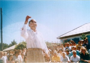
He has since passed on and I believe that he was selected by his Uyghur heritage - his genetics permitted him to access information that harkens back to the Great Uighur Empire. There is a mantra to chant that he purports changes consciousness, not just the person reciting the mantra, but others that he/she is connected with. My visit with Radik Kurbanov (October 2010) was described in the My-Mu.com podcast #23 and the mantra can be heard in the podcast. A followup was covered in this blog posting from early 2011.

The website includes two Pravda articles to say that the 3-D map is 120 million years old and that there was some form of writing on the enormous slabs. Originally it was thought that the inscription was Chinese, however closer examination indicates that is not the case.

So, is the 'Map of the Creator' proof positive that there was an ancient and formally unknown civilization in Central Asia?
Are the unidentified inscriptions similar to anything that James Churchward wrote about and described?
Is this map from the Great Uighur Empire as described by James Churchward?

I'll leave these questions for others to answer, but I would like to interject with some further thoughts.
1. James Churchward's theories include the hypothesis that the mountains were not raised until ten to twelve thousand (10,000 - 12,000) years ago. How could a map be made of mountains before they were raised?
2. If these maps are left behind from the cataclysm that destroyed the eastern half of the Great Uighur Empire, the inscriptions should resemble what James called 'Uighur-Maya' writing. According to James, all the people that left Mu in the peopling of the rest of the Earth were called 'Maya' and 'Uighur-Maya' denotes those individuals that traveled to Asia and formed Mu's Primary Colony, the Great Uighur Empire.

More information about the Great Uighur Empire is available on the My-Mu.com website. The direct link to the page is here.

Have a great day.

Saturday, December 17, 2011

Sunken Landmass(es) Found

Last month (Nov. 2011,) a report from the University of Sydney remarked that two sunken islands the size of Tasmania were found off the west coast of Australia. From Wikipedia, I learned that the area of the main island of Tasmania is a little over 24,000 square miles (62,409 sq. km.,) so these islands are not exactly small.

Entitled, "Sunken islands could cause tectonic shift in Gondwana story," the scientists noted that the finds were discovered almost a mile (1.5 km) beneath the surface and the expedition was able to collect samples. To provide a couple of quotes from the article:

"The sunken islands charted during the expedition have flat tops, which indicates they were once at sea level before being gradually submerged," said Dr Whittaker.

and
Dr Williams commented: "A detailed analysis of the rocks dredged up during the voyage will tell us about their age and how they fit into the Gondwana jigsaw."


This isn't the smoking gun for James Churchward's theory of a sunken Pacific Ocean continent that he called Mu, however it does provide more information about how the continents moved about the planet. From this we may be able to pinpoint the real location of the often hypothesized advanced ancient civilization.

These findings from the Southern Surveyor expedition have more to do with continental drift rather than other sunken features discussed previously.

For instance, in entries entitled, "James Churchward’s Western India Discovery?" and "Another Submerged Civilization Rises," evidence of man-made structures were found dating back to at least 8,000 years ago, sunken under water. Researchers in Florida are traveling miles out in the Gulf of Mexico to recover evidence of human habitation, so obviously we still do not know the complete story.

And earlier this year, Dale Drinnon posted information on the Darwin Rise entitled, "Lost Mu’s Geological Counterpart, The Darwin Rise," and "Another Darwin Rise Page."

There is a specific Geological structure recognised by science which corresponds to the continent of Mu as stated by James Churchward in his Lost Continent of Mu books and that structure is known as the Darwin Rise.


(climbing on soapbox)
The story was also covered in an article entitled, "Evidence Of Lost Continent Of Mu Found? Sunken Islands Could Cause Tectonic Shift In Gondwana Story" and actual information from the wikipedia entry on James Churchward or the 'Mu (lost continent)' was used. While a lot of James pronouncements have been shown to be inaccurate, it seems that the focus tends to highlight those points that time has proved incorrect. This isn't a defense of the inaccuracies, I don't shy away from disagreeing with my great-grandfather's theories. My point would be that James postulated a common ancestry of all human beings (which science shows us is true); that we are all born with a part of the divine spark that sets us apart from other creatures and that realization, coupled with our shared human existence should encourage human beings to 'get along.' This isn't a call for everyone to sit around a campfire and sing 'Kumbaya,' but certainly, if we used less angry words and walked a mile in our neighbor's moccasins, perhaps we could see a better tomorrow. Please don't throw out the baby with the bathwater.
(climbing down from soapbox)

Have a great day,
Jack E. Churchward